Drone Mapping for Vineyards — The Good, the Bad, and the Ugly 🍇
In the race toward data-driven viticulture, many vineyards have adopted NDVI-based drone imagery for health assessments. While drone mapping offers beautiful heatmaps and an appealing overview, it often feels like a black box. What does it actually mean when a vine has an NDVI score of 0.3? Is it diseased, underwatered, or just shaded by a tall cover crop?
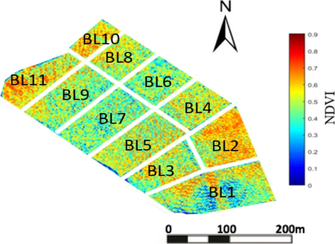
The truth is, NDVI isn’t a diagnostic tool—it’s a vague proxy for “greenness.” In vineyards where every vine has a unique history and financial impact, vague isn’t good enough. You’re left with a pretty map and a question: “Now what?”
Visual Comparison: NDVI vs Sentinel
Exihibit A - Your typical NDVI-based vegetation index map – beautiful but abstract.

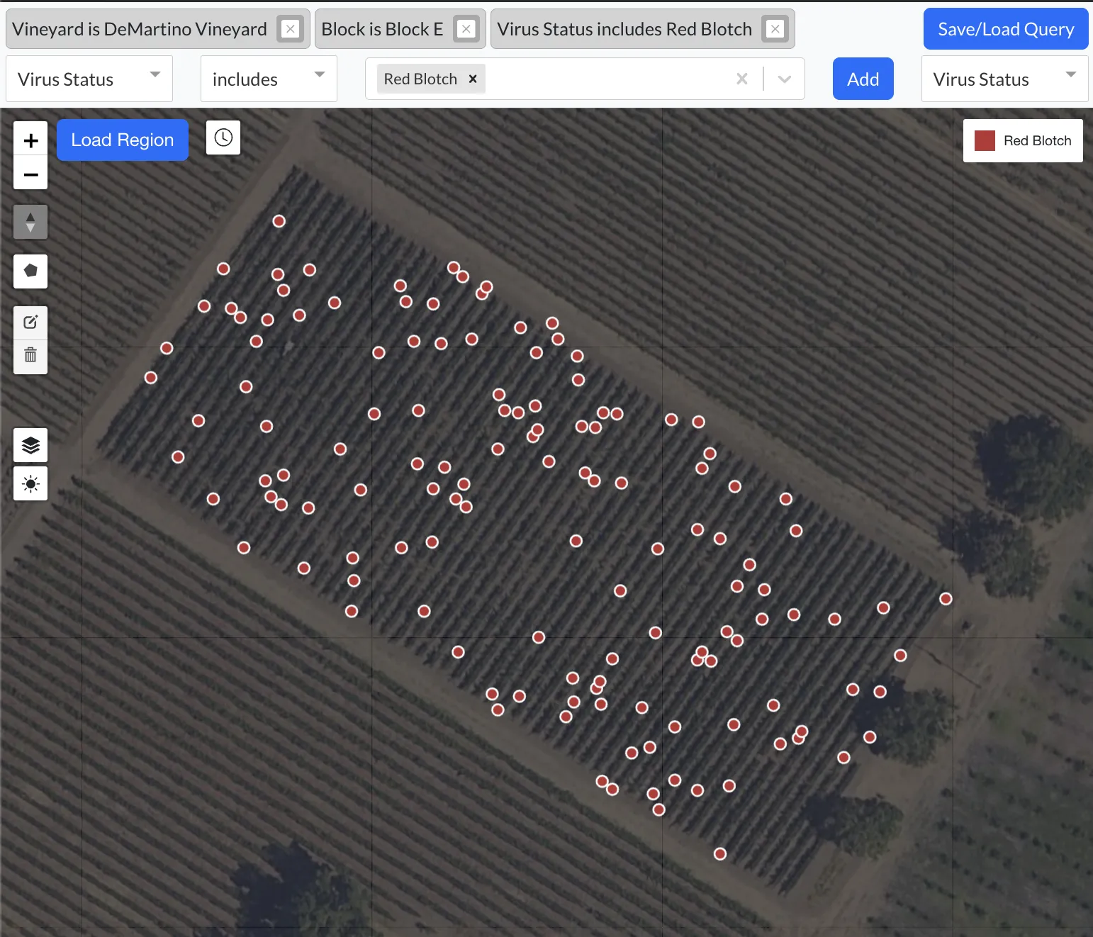
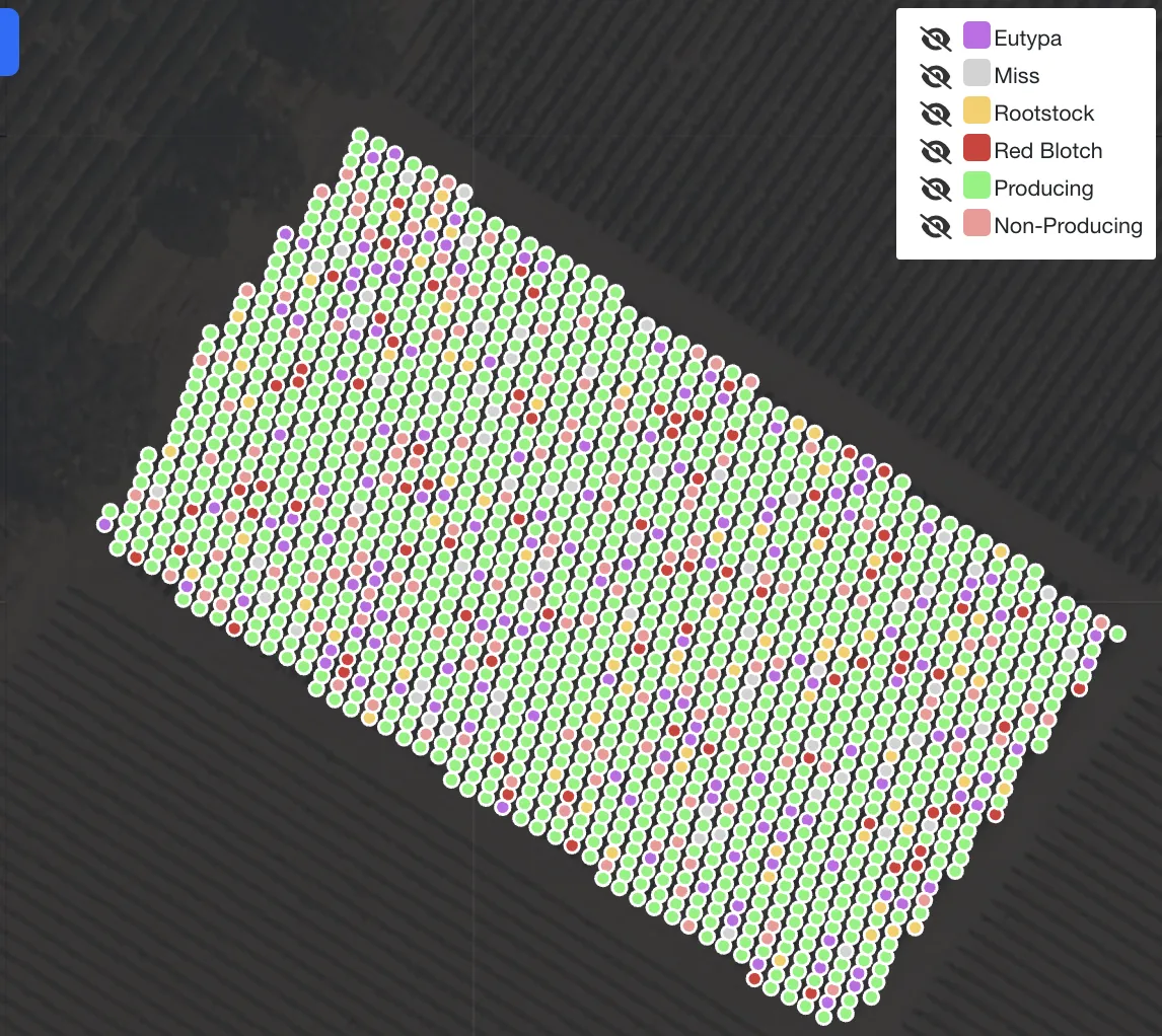
Exhibit B - A Sentinel Vine Manager map, with each vine pinpointed and its status directly actionable.

🚩 The Limitations of NDVI Drone Mapping
Drone-based mapping certainly has its appeal: fly a field, get a heatmap, and highlight “areas of concern.” But for vineyards aiming to make operational decisions—like roguing, irrigating, or tracking Red Blotch—NDVI alone falls short.
Here’s why:
- 🌿 NDVI is not vine-specific: Drones collect overhead canopy data. But what if the cover crop is tall and green, or the vine is struggling below but still has canopy?
- 🦠 NDVI doesn’t track disease: Viruses like Red Blotch and Leafroll often don’t show visible signs until late in the season—if at all.
- 📅 NDVI doesn’t tell you history: You can’t see whether a vine had the same score last year, was flagged previously, or is due for removal.
- ❌ Provider vine count inaccuracies: Even providers claiming to identify individual vines from aerial imagery face occlusion from overlapping canopies or shadows, leading to missed vines—especially along block edges. UAV-based systems frequently undercount vines, and when compared to ground-truthed Sentinel maps, these aerial outputs show consistent and material inaccuracies. For any high-value site, that margin of error isn’t acceptable.
Other vegetation indices like EVI (Enhanced Vegetation Index) and SAVI (Soil-Adjusted Vegetation Index) attempt to refine spectral sensitivity or adjust for soil brightness, but ultimately they suffer from the same core issue: they remain indirect proxies for “vigor” or “greenness,” not precise measures of health or productivity.
Adding to the challenge, these indices fluctuate significantly throughout the growing season due to canopy changes, irrigation cycles, lighting conditions, and even time of day. This variability makes it very difficult to operationalize drone imagery reliably. You can’t set a fixed rule like “trigger an alert when NDVI drops below 0.4” because that threshold won’t mean the same thing week to week.
These tools are best suited for relative comparisons—such as deciding which blocks to pick first based on vigor—not for vine-level diagnostics or disease tracking.
🚀 The Sentinel Solution: Vine-Level Intelligence That Lasts
Sentinel Vine Manager was designed from the ground up to close this gap. Instead of relying on spectral indices from above, it uses sub-centimeter GNSS accuracy combined with a smartphone to map every vine precisely—then maintain a living history of that vine's health, productivity, and treatments.
Here’s how it works:
- 📍 Sub-centimeter mapping: Every vine is dropped once with GNSS accuracy. No double entry, no re-mapping each year.
- 🗂️ Custom vine records: Track Red Blotch status, production status, interplant date, and even attach photos to vines.
- ⚙️ Operational integration: Create work orders, assign tasks, and automatically update vine statuses based on activity.
- 📈 Year-over-year insights: See how a vine has changed over 2, 5, or 10 years. Did a virus spread? Is production declining? It’s all there.
Sentinel isn’t just a data collection tool—it’s a decision-making platform.
NDVI Tells You “Where,” Sentinel Tells You “Why”
NDVI can show you a “red zone.” But Sentinel tells you:
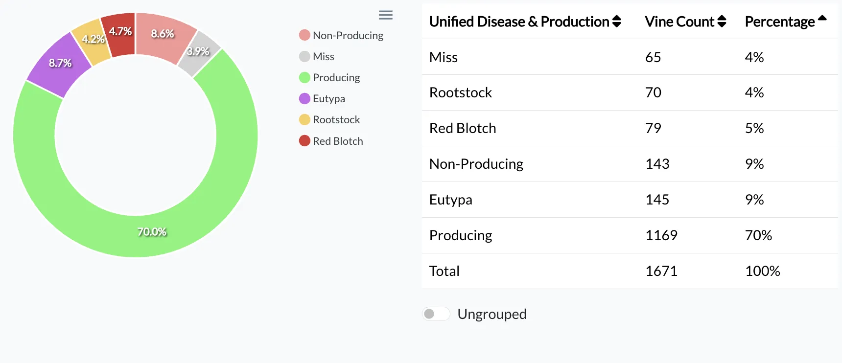
- Exactly 79 vines in this block have been flagged with Red Blotch.
- Roguing and replanting efforts have already begun—Sentinel clearly shows the missing vines and the newly planted rootstocks (with precise counts!).
- Without immediate intervention, you’re looking at a full-block replant by 2025. With Sentinel, you can send your finance team a clear, concise image, instantly communicating the urgency and securing the necessary budget. 😉💰


This is operationally relevant, ground-truthed data. Not just pixels.
💰 The Bottom Line: Sentinel Pays for Itself
When you're managing high-value fruit in Napa, Oregon, or even Australia or New Zealand, the cost of losing vine productivity—or replanting too early—can be massive.
With Sentinel, you:
- Eliminate Excel
- Eliminate clipboard double-entry
- Save 30–60% of scout labor time
- Extend vineyard lifespan by 5–10 years
- Make better decisions based on real, historical vine data
🎯 Ready to Upgrade from “Green Blobs” to Precision?
NDVI has its place—as a high-level scout. But to farm smarter, longer, and with fewer surprises, you need something deeper.
Sentinel Vine Manager is that solution.
👉 Schedule a demo today and see how it works in Napa, Oregon, or wherever you grow.